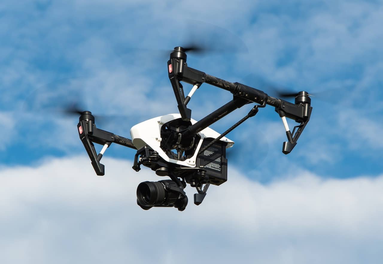
Drones have evolved far beyond simple flying cameras. Today’s unmanned aerial vehicles (UAVs) are equipped with advanced sensors and imaging technologies that allow them to capture detailed data about the world—from high‑resolution photographs to thermal heat signatures and 3D terrain models. Understanding these technologies helps you choose the right drone for photography, mapping, inspection, agriculture, or scientific research.
This article breaks down the most common drone sensors and imaging systems, how they work, and what they’re used for.
1. RGB Cameras (Standard Visual Imaging)
What They Are
RGB cameras capture images using red, green, and blue light—just like smartphone or DSLR cameras.
Key Features
- High-resolution photos and videos (up to 8K on some drones)
- Adjustable aperture and shutter speed on advanced models
- Mechanical or electronic shutters
Common Uses
- Aerial photography and videography
- Real estate marketing
- Social media and filmmaking
- Visual inspections (roofs, towers, bridges)
Limitations
- Depend on good lighting
- Cannot see beyond the visible spectrum
2. Thermal Imaging Sensors
What They Are
Thermal cameras detect infrared radiation (heat) emitted by objects, creating images based on temperature differences.
Key Features
- Measures surface temperature variations
- Works in complete darkness or smoke
- Often paired with RGB cameras
Common Uses
- Search and rescue operations
- Building and roof inspections
- Firefighting and hotspot detection
- Wildlife tracking
- Solar panel inspections
Limitations
- Lower image resolution than RGB cameras
- More expensive
- Limited ability to identify visual details
3. Multispectral Sensors
What They Are
Multispectral sensors capture data across several specific wavelength bands, often including near‑infrared (NIR) and red‑edge bands.
Key Features
- Captures 4–10 discrete spectral bands
- Enables vegetation analysis and indices like NDVI
- Highly calibrated for data accuracy
Common Uses
- Precision agriculture
- Crop health monitoring
- Environmental research
- Forestry management
Limitations
- Not suitable for general photography
- Requires specialized software for analysis
4. Hyperspectral Sensors
What They Are
Hyperspectral sensors collect data across hundreds of narrow spectral bands, creating a detailed spectral signature for every pixel.
Key Features
- Extremely detailed material identification
- Detects subtle chemical and biological differences
- Produces large datasets
Common Uses
- Scientific research
- Mineral exploration
- Environmental monitoring
- Defense and surveillance
Limitations
- Very expensive
- Heavy payloads
- Complex data processing requirements
5. LiDAR (Light Detection and Ranging)
What It Is
LiDAR uses laser pulses to measure distances, creating highly accurate 3D models of terrain and structures.
Key Features
- Penetrates vegetation to measure ground elevation
- Produces dense point clouds
- Extremely accurate depth measurements
Common Uses
- Surveying and mapping
- Forestry canopy analysis
- Construction planning
- Archaeology
- Flood modeling
Limitations
- High cost
- Requires advanced processing software
- Typically used on professional drones
6. Radar Sensors
What They Are
Radar sensors use radio waves instead of light to detect objects and measure distances.
Key Features
- Operates in all weather conditions
- Detects motion and obstacles
- Longer range than optical sensors
Common Uses
- Obstacle avoidance
- Terrain following
- Military and industrial applications
Limitations
- Lower spatial resolution
- Limited use in consumer drones
7. Time-of-Flight (ToF) Sensors
What They Are
ToF sensors calculate distance by measuring how long it takes light to return after being emitted.
Key Features
- Fast depth sensing
- Compact and lightweight
- Common in obstacle detection systems
Common Uses
- Obstacle avoidance
- Indoor navigation
- Autonomous flight systems
Limitations
- Shorter range than LiDAR
- Less precise for mapping
8. Event-Based and AI-Enhanced Sensors
What They Are
Event-based sensors detect changes in a scene rather than capturing full frames, often paired with AI processing.
Key Features
- Ultra-fast response times
- Low power consumption
- AI-driven object detection and tracking
Common Uses
- Autonomous drones
- High-speed tracking
- Research and robotics
Limitations
- Emerging technology
- Limited consumer availability
Sensor Fusion: Combining Technologies
Modern drones often use multiple sensors simultaneously, a technique called sensor fusion. For example:
- RGB + thermal for inspections
- LiDAR + RGB for accurate 3D mapping
- Multispectral + AI for precision agriculture
Sensor fusion improves accuracy, reliability, and situational awareness.
Choosing the Right Drone Sensor
Ask yourself:
- What data do I need? (visual, thermal, terrain, vegetation)
- What level of accuracy is required?
- What is my budget and payload capacity?
- Do I have the software skills to process the data?
Final Thoughts
Drone sensors and imaging technologies have transformed drones into powerful data‑collection platforms. Whether you’re capturing cinematic footage, analyzing crop health, mapping terrain, or conducting industrial inspections, the right sensor makes all the difference.
As sensor technology continues to advance—especially with AI and miniaturization—drones will become even more capable, opening new possibilities across industries.